Get in touch
Leadville Visitor Center
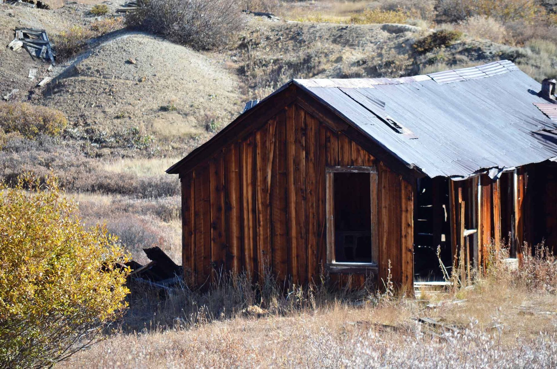
Take a driving tour through the 20-square-mile historic mining district surrounding Leadville. The tour is on dirt roads, and most roads are passable in cars. The Route of the Silver King tour has 14 stops, including mines, power plants, ghost towns, and mining camps.
On your tour, please treat the mining district with care. It is located entirely on private land. The few remaining structures are fragile and dangerous. Respect “No Trespassing” signs, and do not enter mine shafts or tunnels. No rock hounding, treasure hunting, metal detecting or digging are allowed.
The route is 21 miles or 34 kilometers long and rises from 10,152 feet (City Hall Bench Mark) in Leadville to 11,700 feet at Stop 14; the Venir Mine site. It follows county roads that are mostly gravel/dirt surface with some pavement. Some areas can be rough and steep in places. The 14 stops are marked by metal roadside posts, each with a small numbered yellow sign.
Short segments of county roads CR-1, CR-2 and CR-3, immediately east of Leadville, may be plowed during the winter. Segments that may be plowed are shown in blue on the Winter Route map. The remainder of the route shown in orange is not accessible to rubber-tired vehicles during the winter.
For the route, see the Leadville/Lake County Heritage Guide. You can pick up a printed guide at the Herald Democrat (717 Harrison Ave.), the Visitor Center (460 Harrison Ave.), or other town locations.
Visit RouteoftheSilverKings.org and go virtual and follow the route in real time with Avenza GIS or Global Mapper GIS apps. Cell and WiFi coverage are limited along the route. It is recommended that maps be downloaded ahead of time.


Visit Leadville Twin Lakes, Colorado on Another Level
VISITOR CENTER WINTER HOURS: THURS - MON 10AM TO 4PM
CLOSED TUES & WED
460 HARRISON AVE LEADVILLE, CO 80461
719-486-3900